Dr Harry Gibson

Geospatial Data Scientist
I'm an experienced geospatial software developer and data scientist. I currently work in the Oxford Martin School research programme on Informal Cities.
More About Me | Portfolio
LinkedIn | ResearchGate | Google Scholar
Making Research Accessible
Publicising research outputs through interactive web mapping applications
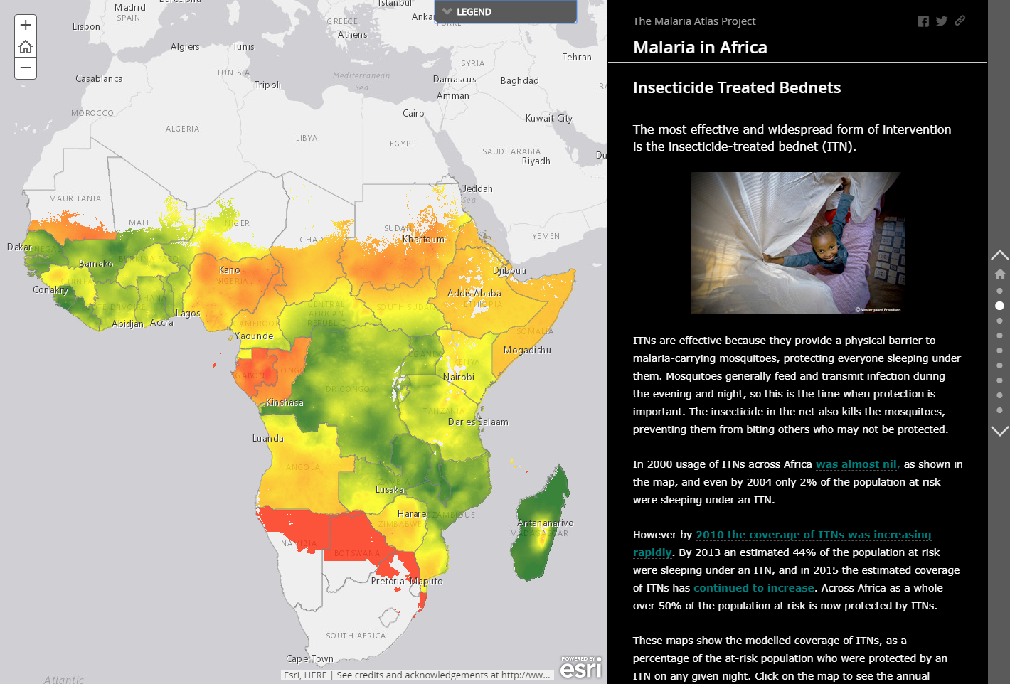
In 2015, colleagues in the Malaria Atlas Project published in Nature a landmark paper quantifying the changes in malaria burden in Africa since 2000, and showing how the reduction in cases since then can be attributed to “intervention” efforts, such as the widespread distribution of mosquito bednets.
This paper caused great interest, particularly due to the headline grabbing figure that 663 million cases of malaria had been averted by these interventions since 2000.
In an effort to make the research accessible as widely as possible, I created this ESRI Story Map. This involved summarising and explaining the research in accessible language, configuring ArcGIS Image Services, hosting summary data on ArcGIS Online, and authoring the presentation. ArcGIS Online (and Enterprise) provides a rich environment for authoring many different kinds of map-based presentations and web applications and is the ideal platform for this kind of work. A great deal can be done without any coding knowledge and for those who are able the code of the templates can be extended and modified to fit specific needs.
The Story Map was well received and is featured by ESRI in their flagship “Living Atlas” gallery of top ArcGIS Online content.
Note that unfortunately as of December 2019 some of the data in the map are no longer available to external viewers due to publication decisions beyond my control! The Story Map has been left up in the hope we can agree a fix to this as soon as possible…