Dr Harry Gibson

Geospatial Data Scientist
I'm an experienced geospatial software developer and data scientist. I currently work in the Oxford Martin School research programme on Informal Cities.
More About Me | Portfolio
LinkedIn | ResearchGate | Google Scholar
Portfolio
Hi! I’m Harry Gibson, a geospatial software developer from Oxfordshire, UK. This site describes some of my most interesting pieces of work. You can find out more about me here - please get in touch if you’d like to know more about anything you read here.
Remote Sensing and Google Earth Engine
I’ve spent quite a bit of time over the last few years working with Google Earth Engine. It’s really sparked my interest in remote sensing and is an incredible resource for working with the massive data volumes involved, as well as for publishing analyses. This section lists just a few of the most inspiring pieces of work I’ve done with it.
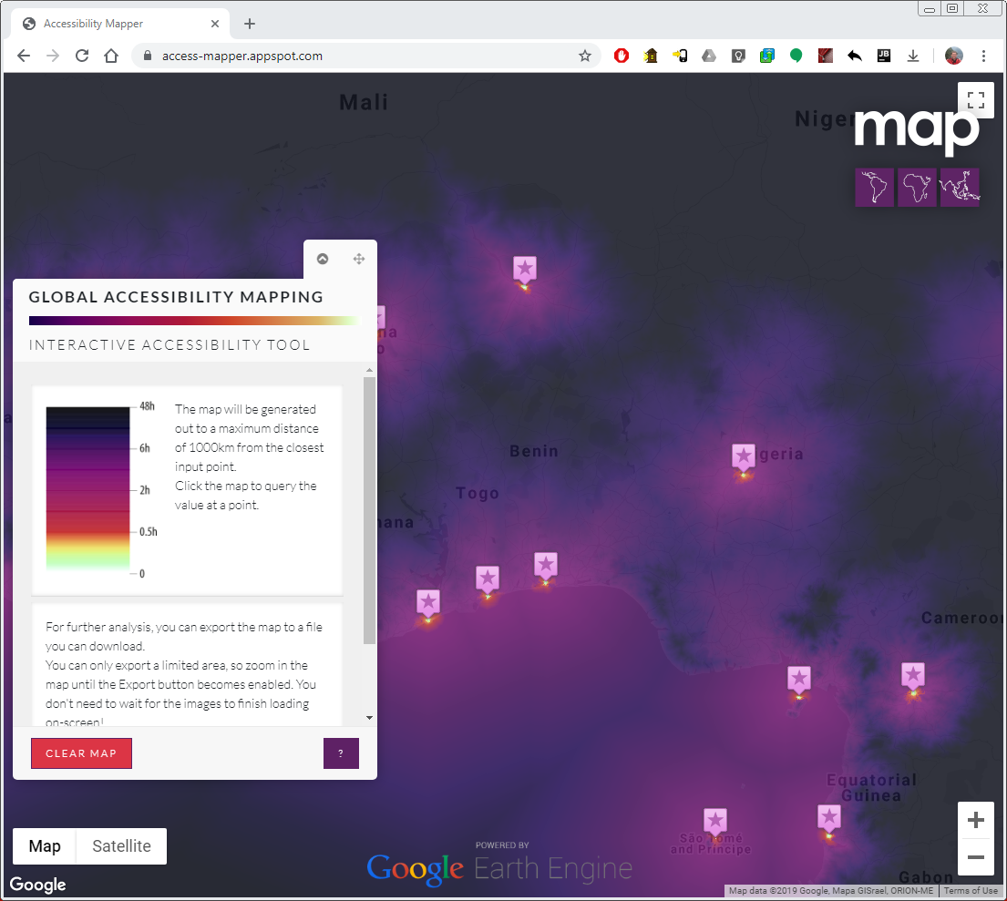
Accessibility Mapping Tool
Making scientific research outputs more accessible by lowering the knowledge barrier for interacting with the results
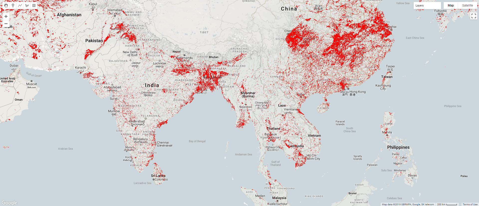
Mapping paddy rice growth in Google Earth Engine
Implementing complex processing chains on raster data, using Google Earth Engine to vastly increase the feasible scope of analysis
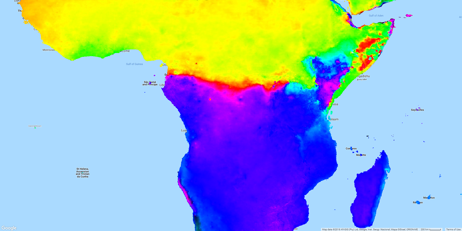
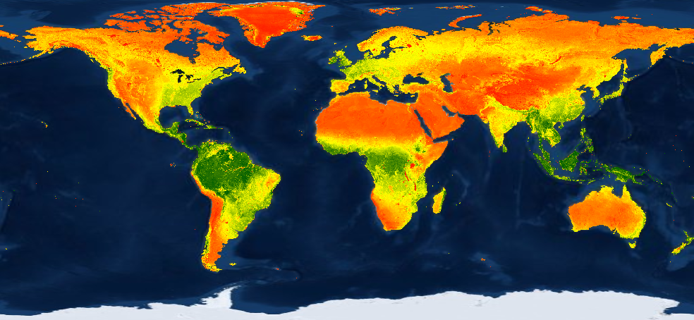
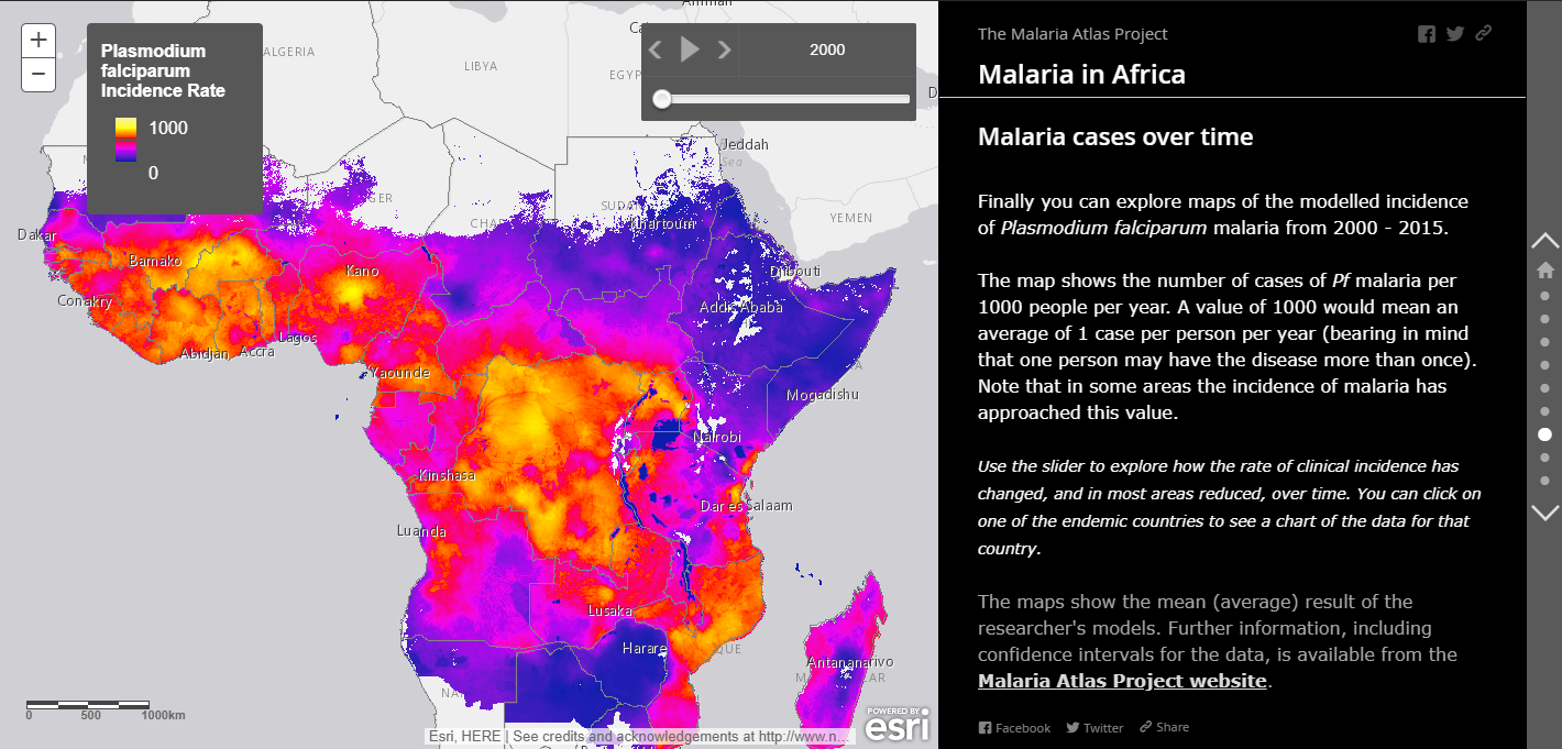
Investigating seasonality of rainfall in Google Earth Engine
Quickly processing very large source datasets to produce maps characterising continental-scale patterns of rainfall, supporting modelling of malaria seasonality
High-performance raster data processing
Within MAP (the research group I work in) we use a lot of remotely-sensed and other raster datasets as covariates to our geostatistical models. I’m responsible for producing these, and we hold many thousands of gigapixel-scale images.
More often than not I write the algorithms needed using Cython, an extension to Python which generates C code from Python. This section describes some of the more complex code I’ve produced and there’s a presentation I gave explaining why I did it this way.
Gapfilling planetary-scale raster datasets
High-performance Python implementation of large scale raster processing algorithms
Writing Performant Raster Processing Code
A training presentation given to colleagues, introducing computer-science concepts
relevant to writing high-performance code for processing raster datasets
Advanced geoprocessing and spatial data manipulation
In my current role I primarily work with raster-format geospatial data, as that is what our models are all based on.
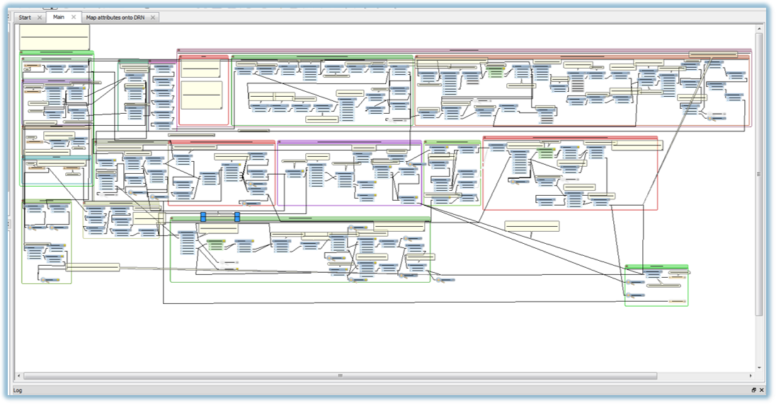
However I also have extensive experience in designing and implementing advanced geoprocessing workflows for vector-format geospatial data and my computer science background allows me to think laterally about appropriate algorithms for many tasks, whether or not they are available in the toolboxes of off-the-shelf GIS software. As well as writing these from scratch and using desktop GIS software, I have for many years been an expert user of FME (Feature Manipulation Engine) for this and many other purposes.
Generation of a national Continuous Defence Line for flood modelling
Using FME to design and implement a complex geoprocessing workflow for the automation of a major GIS editing and integration task
Other data processing and extraction
I don’t just use raster data, or even geospatial data, in my work. We use raster data as covariates (predictors) in our models but we also need response data - the thing we are trying to model. One of the major sources of this is national survey data from the DHS - I’ve written code and FME workbenches that mean we can draw on all available survey data without having to manually process each new survey.
Demographic and Health Survey data
Making it possible to process the whole body of DHS survey data enabling more and better usage of the data across our research
Outreach
Web mapping applications for science communication
Creating a rich, interactive web mapping presentation to accompany the launch of a major publication
Older work
Creating shapefiles in Javascript
Way back in 2012 I was working at the Centre for Ecology and Hydrology, in the National River Flow Archive. I created a Javascript application using the ESRI Javascript API and ArcGIS Server, to allow colleagues to interact with the wealth of geospatial data we held about UK river catchments.
Perhaps the most interesting part about this was the JS2Shapefile library I wrote. This used the nascent ability of browsers of the day to work with binary data, to create shapefiles directly in the browser from features displayed on the web map. There’s definitely better ways of doing this now, but I think it’s interesting to see what could be done that long ago!
Page template forked from evanca